
Narasapur Fm
Type Locality and Naming
LANDWARD: Named after the Narasapur town. Type section is in the Well Narasapur-A (depth interval: 205-330 m). [Original Publication: Venkatarengan, R., Rao, G.N., Prabhakar, K.N., et al., (1993b) Lithostartigraphy of Petroliferous Basins, Document VIII, Krishna Godavari Basin, KDMIPE, ONGC Publication, pp. 1-29.]. Reference well: Well Vadaparru-A, Interval 270-700 m and thickness is 430m.
Synonyms: Narasapur Claystone; Narasapur Clay
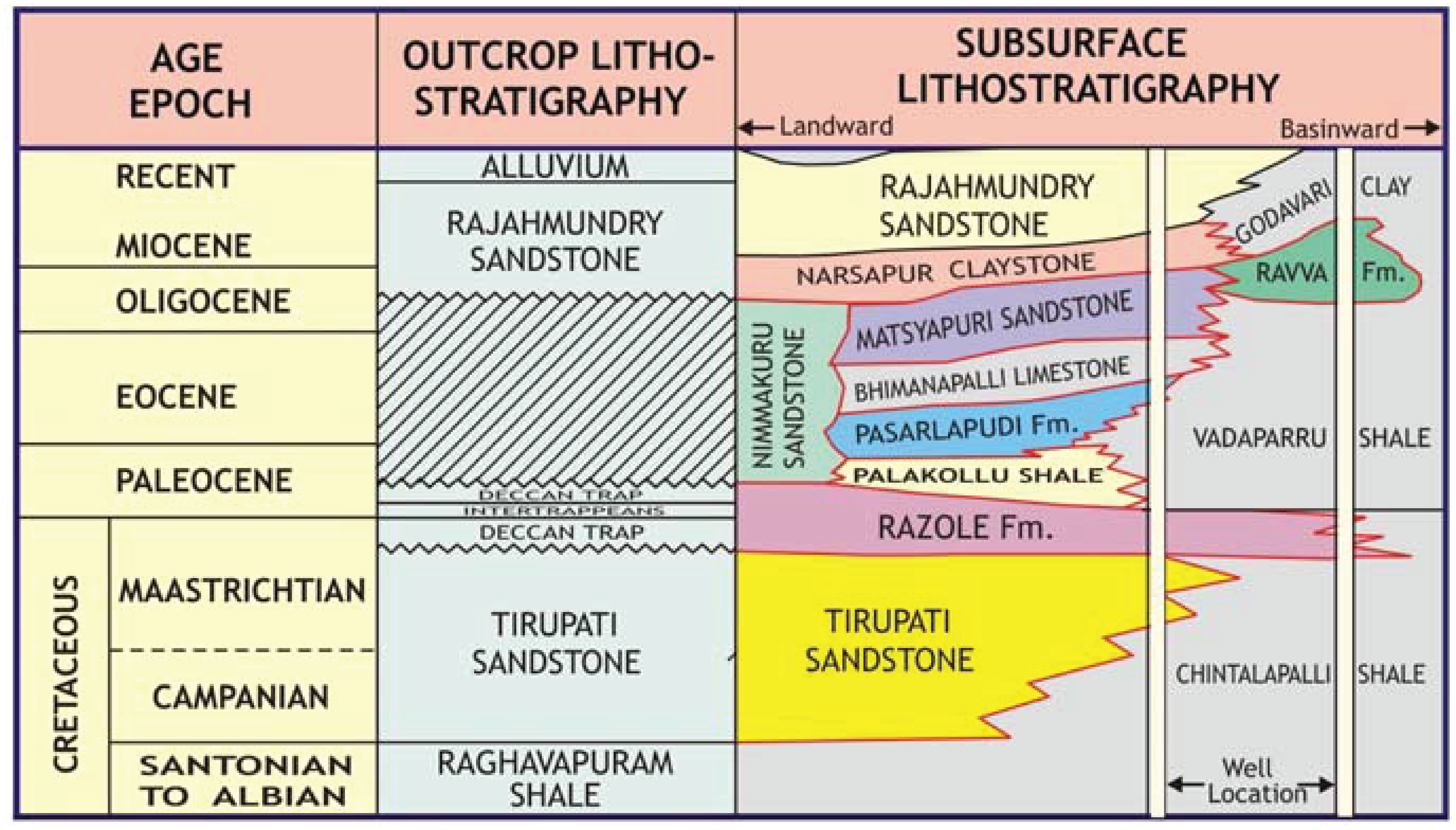
[Figure: Generalized Late Cretaceous-Cenozoic lithostratigraphy transect, Krishna-Godavari Basin. From Keller et al., 2011, Jour. Geol. Soc. India, 78:399-428, their Fig. 2]
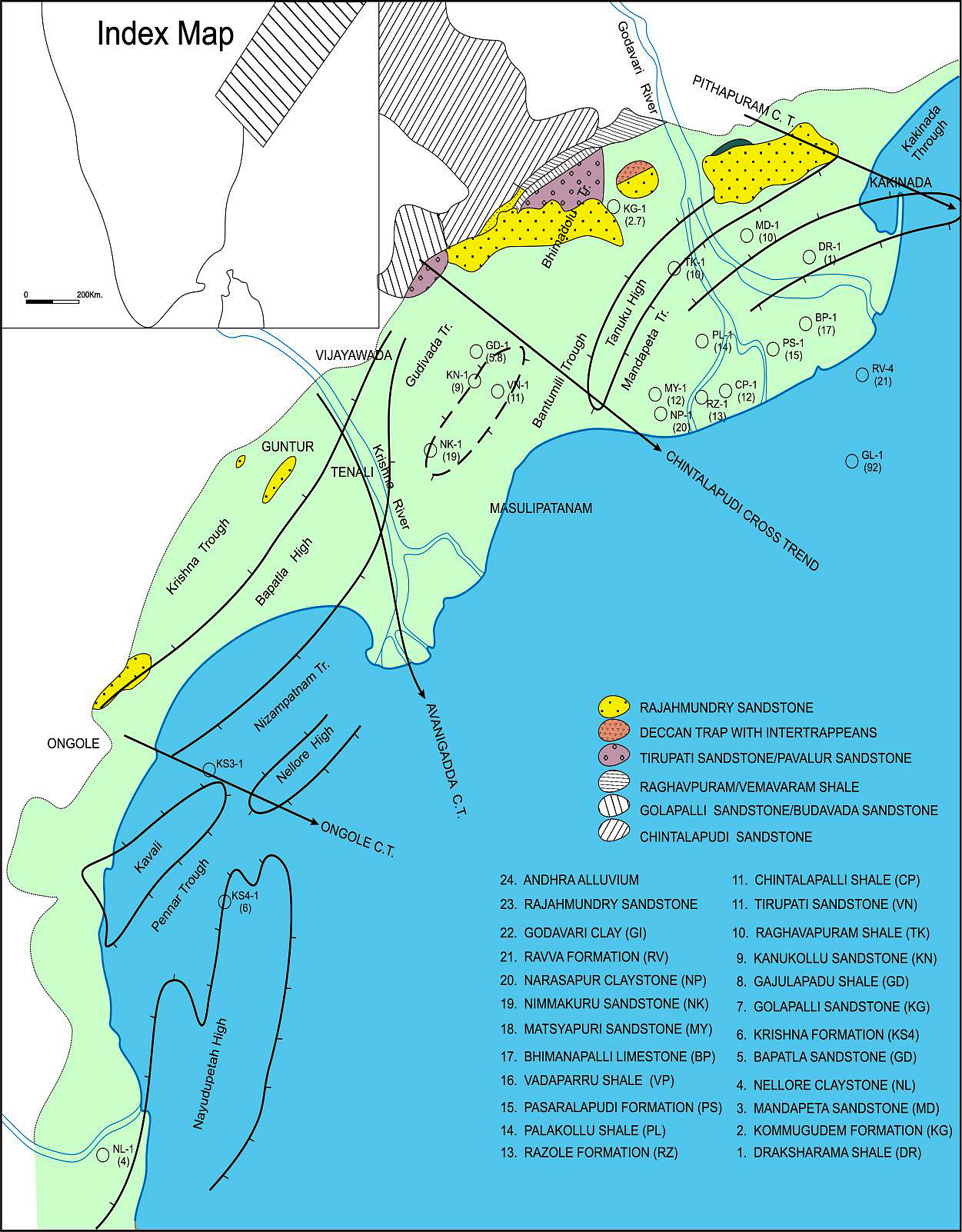
[Figure: Map showing the locations of designated holostratotype section for the formation in the KG Basin (After ONGC, Pandey and Dave, 1998) in Raju et al., 2021, ONGC Bulletin, Special Issue, Vol. 56, No. 2]
Lithology and Thickness
Sandy claystone. The lithology of the formation is dominantly claystone with minor sandstones at places. The claystones are dark grey to black, feebly calcareous to non-calcareous, plastic, carbonaceous and sometimes silty. The sandstone includes pebbles and granules of yellowish quartz. In reference section, the lithology is mainly dark grey to brown, soft sticky and non-calcareous clays. The thickness of the formation in Narasapur-A is 125 m and in Vadaparru-A 430 m.
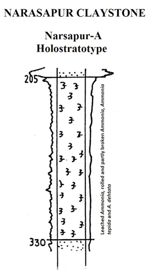
[Figure 1: Well log of Narsapur-A Holostratotype (modified after Venkatarengan et al., 1993)]
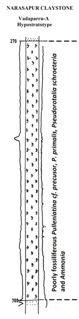
[Figure 2: Well log of Vadaparru-A Hypostratotype (modified after Venkatarengan et al., 1993)]
Relationships and Distribution
Lower contact
Conformably underlain by Matsyapuri Fm Sandstone (offshore, but not basinal) or Nimmakuru Fm Sandstone (most landward)
Upper contact
Conformably overlain by Rajahmundry Fm.
Regional extent
GeoJSON
Fossils
The succession of the type section is poorly fossiliferous and include leached Ammonia, rolled and partly broken Ammonia tepida, A. dentata. At some levels no microfauna is found. The unit overlies strata containing Globorotalia tosaensis which occurs between 459-480m. In reference section the sediments are also poorly fossiliferous but contain Pulleniatina cf. precursor, P. prinalis, Pseudorotalia schroeteriana and Ammonia
Age
Depositional setting
Varies from inner to outer neritic
Additional Information